![](/images/other/stat-length.png)
![Tour Wandern Florac Trois Rivières - de Florac à St Enimie par le Causse de Sauveterre - Photo](https://media.geolcdn.com/t/1900/400/166b8a72-b2d0-4c55-bf4e-bd92beaeab4e.jpg&format=pjpeg&maxdim=2)
de Florac à St Enimie par le Causse de Sauveterre
canardDenis
Benutzer
![Länge](/images/other/stat-length.png)
![Maximale Höhe](https://static1.geolcdn.com/siteimages/upload/files/1508320355ic_sort_altitude_max_24dp.png)
![Positive Höhendifferenz](https://static1.geolcdn.com/siteimages/upload/files/1508320355ic_sort_den_pos_24dp.png)
![Km-Effort](/images/other/stat-length.png)
![Min. Höhe](https://static1.geolcdn.com/siteimages/upload/files/1508320355ic_sort_altitude_min_24dp.png)
![Negative Höhendifferenz](https://static1.geolcdn.com/siteimages/upload/files/1508320355ic_sort_den_neg_24dp.png)
![Boucle](https://static1.geolcdn.com/siteimages/upload/files/16400158638029165_repeat_loop_refresh_sync_direction_icon.png)
![Wandern](https://static1.geolcdn.com/sitytour/trail-icons/101.png)
9h26
Schwierigkeit : Sehr schwierig
![Scannen Sie diesen QR-Code, um die Tour in der SityTrail-Anwendung zu öffnen](https://capi.geolives.com/qq0zvz2zws4bq2lad0pu/sitytour/trails/3291015/qr.png?size=200)
Kostenlosegpshiking-Anwendung
Über SityTrail
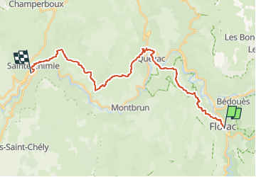
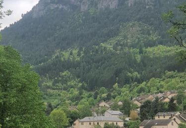
Tour Wandern von 27 km verfügbar auf Okzitanien, Lozère, Florac Trois Rivières. Diese Tour wird von canardDenis vorgeschlagen.
Beschreibung
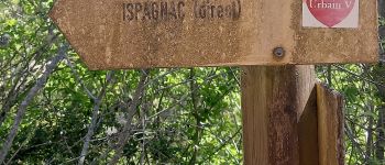
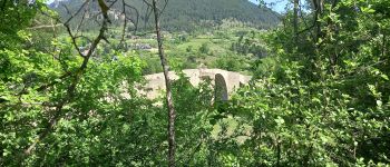
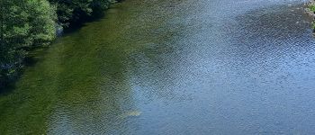
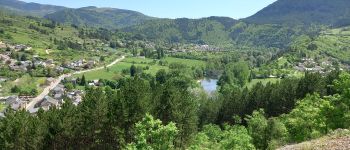
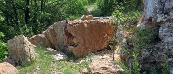
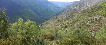
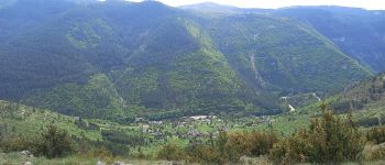
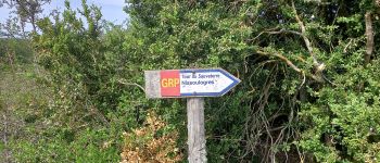
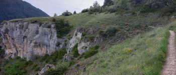
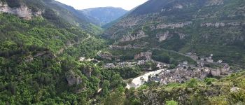
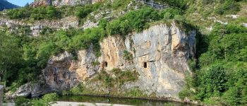
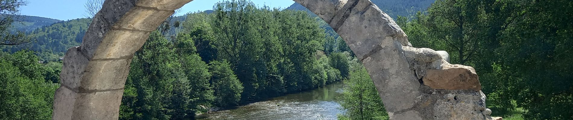
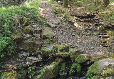
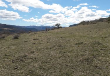
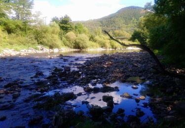
Cette quatrième étape s'écarte délibérémént du tracé officiel qui longe le Tarn en Rive gauche sur tout son parcours. Le but est de s'éloigner de la route de Mende (N106) très bruyante qui borde aussi le Tarn en Rive droite juqu'à Ispagnac. Ce tracé visite la pointe du Causse Méjean jusqu'à Quézac avant de passer en Rive Droite pour grimper rejoindre le GRP® Causse du Sauveterre et redescendre vers St Enimie.
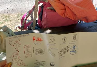
POIs
Ort
Kommentare
Touren in der Umgebung
![Tour Wandern Florac Trois Rivières - Le Sentier des Couronnes - Florac - Photo](https://media.geolcdn.com/t/375/260/ext.jpg?maxdim=2&url=https%3A%2F%2Fservices.sitytrail.com%2FGeolivesWS%2FDownloadMedia.ashx%3FTrailID%3D129855%26Media%3D13413_6.jpg)
![Wandern Wandern](https://static1.geolcdn.com/sitytour/trail-icons/101.png)
Wandern
![](/images/other/stat-length.png)
![](https://static1.geolcdn.com/siteimages/upload/files/16400158638029165_repeat_loop_refresh_sync_direction_icon.png)
![Tour Wandern Bédouès-Cocurès - Stevenson Bedouès Barre des Cévennes - Photo](https://media.geolcdn.com/t/375/260/86b0857f-5630-4b37-8494-7a00373be256.jpg&format=jpg&maxdim=2)
![Wandern Wandern](https://static1.geolcdn.com/sitytour/trail-icons/101.png)
Wandern
![](/images/other/stat-length.png)
![](https://static1.geolcdn.com/siteimages/upload/files/16400158638029165_repeat_loop_refresh_sync_direction_icon.png)
![Tour Zu Fuß Florac Trois Rivières - Florac - Photo](https://media.geolcdn.com/t/375/260/f2a77ee2-7a86-4802-91d2-226710ca6f1c.jpeg&format=jpg&maxdim=2)
![Zu Fuß Zu Fuß](https://static1.geolcdn.com/sitytour/trail-icons/100.png)
Zu Fuß
![](/images/other/stat-length.png)
![](https://static1.geolcdn.com/siteimages/upload/files/16400158638029165_repeat_loop_refresh_sync_direction_icon.png)
![Tour Wandern Florac Trois Rivières - Panoramique des couronnes - Photo](https://media.geolcdn.com/t/375/260/7019c90e-f046-4f38-8c65-fb0ab66f3f22.jpg&format=jpg&maxdim=2)
![Wandern Wandern](https://static1.geolcdn.com/sitytour/trail-icons/101.png)
Wandern
![](/images/other/stat-length.png)
![](https://static1.geolcdn.com/siteimages/upload/files/16400158638029165_repeat_loop_refresh_sync_direction_icon.png)
![Tour Wandern Florac Trois Rivières - Les Cévennes sentiers sympas - Photo](https://media.geolcdn.com/t/375/260/39fe67cd-54e7-4946-b242-3ad32b0a4775.jpg&format=jpg&maxdim=2)
![Wandern Wandern](https://static1.geolcdn.com/sitytour/trail-icons/101.png)
Wandern
![](/images/other/stat-length.png)
![](https://static1.geolcdn.com/siteimages/upload/files/16400158638029165_repeat_loop_refresh_sync_direction_icon.png)
![Tour Wandern Florac Trois Rivières - Etape 8 Florac/Cassagnas - Photo](https://media.geolcdn.com/t/375/260/495f7742-b660-4cb5-bdb0-98f953d0eda5.jpg&format=jpg&maxdim=2)
![Wandern Wandern](https://static1.geolcdn.com/sitytour/trail-icons/101.png)
Wandern
![](/images/other/stat-length.png)
![](https://static1.geolcdn.com/siteimages/upload/files/16400158638029165_repeat_loop_refresh_sync_direction_icon.png)
![Tour Wandern Bédouès-Cocurès - 14-05-2023 E9 Bédouès - Barre des Cévennes - Photo](https://media.geolcdn.com/t/375/260/c49eac84-f99f-43af-9f22-014089784d72.jpg&format=jpg&maxdim=2)
![Wandern Wandern](https://static1.geolcdn.com/sitytour/trail-icons/101.png)
Wandern
![](/images/other/stat-length.png)
![](https://static1.geolcdn.com/siteimages/upload/files/16400158638029165_repeat_loop_refresh_sync_direction_icon.png)
![Tour Wandern Cans et Cévennes - Autour du MAZEL via CROUPILLAC - Photo](https://media.geolcdn.com/t/375/260/da1b2bb7-b6ce-4ec8-b0ac-b09162e24a8f.jpg&format=jpg&maxdim=2)
![Wandern Wandern](https://static1.geolcdn.com/sitytour/trail-icons/101.png)
Wandern
![](/images/other/stat-length.png)
![](https://static1.geolcdn.com/siteimages/upload/files/16400158638029165_repeat_loop_refresh_sync_direction_icon.png)
![Tour Wandern Florac Trois Rivières - Monteils - Photo](https://media.geolcdn.com/t/375/260/6351ca7c-9137-42b9-9788-ad9aa1c918e6.jpg&format=jpg&maxdim=2)
![Wandern Wandern](https://static1.geolcdn.com/sitytour/trail-icons/101.png)
Wandern
![](/images/other/stat-length.png)
![](https://static1.geolcdn.com/siteimages/upload/files/16400158638029165_repeat_loop_refresh_sync_direction_icon.png)